The Maps
Die Landkarten
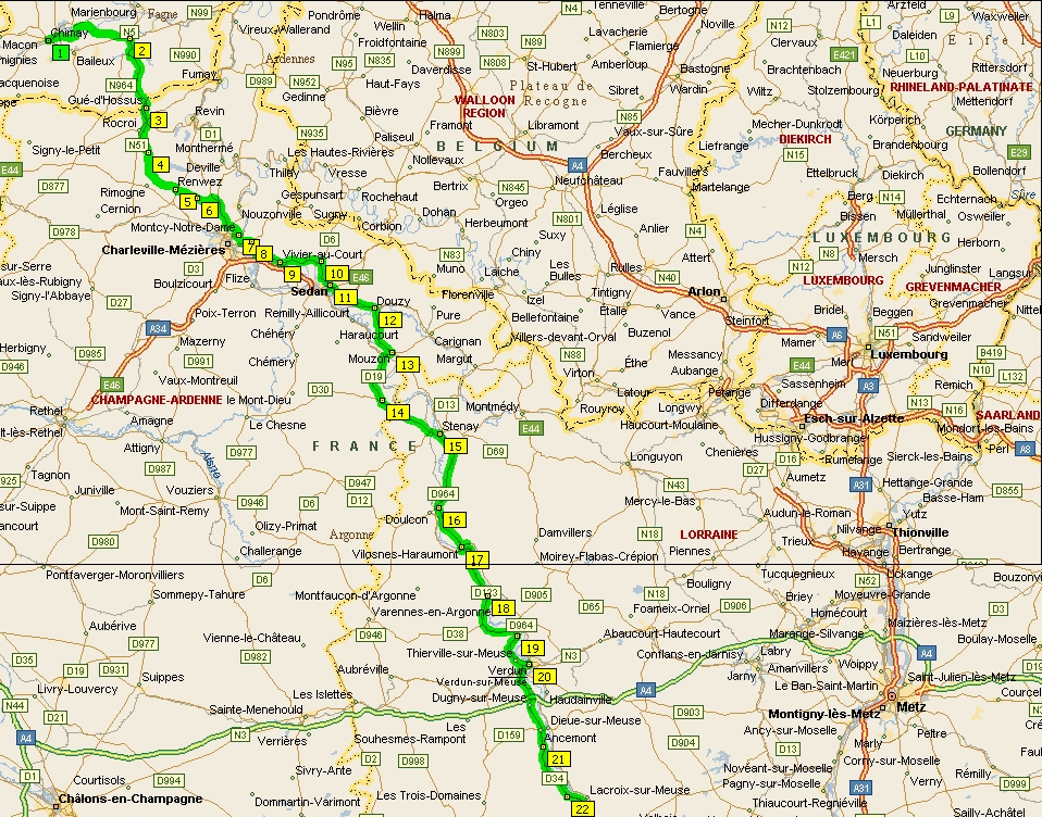
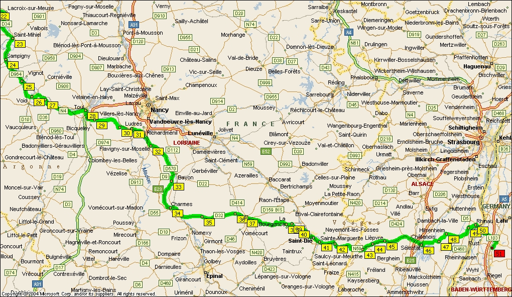
Each map covers an area 21 miles x 12 miles - 33.8 km x 19.3 km
Under each map is a list of campsites within that area
When I arrive at Zeebrugge, I will be getting the train to Chimay, to begin the trip where Wolf and I left off in 1995
|
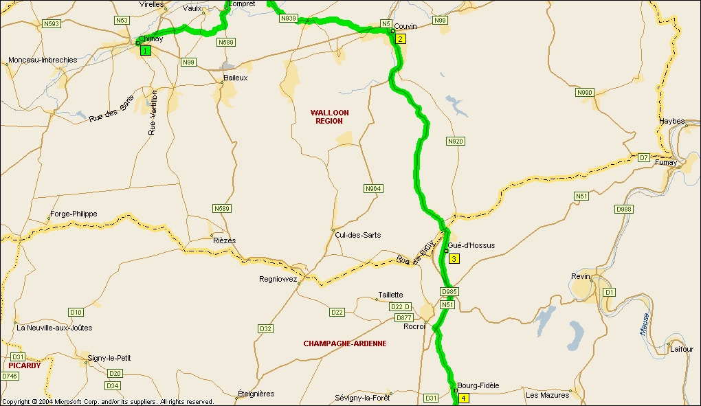
click the map
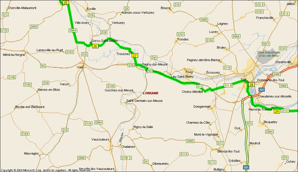
Map 1 |
|
Camping: Bourg-Fidèle - Camping de la Murée, 35, rue Catherine-de-Clèves, 08230 Bourg Fidèle Les Mazures - Le Lac des Vieilles Forges, 08500 Les Mazures
Wolf and I never forgot Le Lac des Vieilles Forges, in the Ardennes forest, where we camped 'sous les arbres' because the site was full, but they would not turn away anyone who came on a bike. We slept on a thick bed of pine needles, the best night of the trip. I shall probably spend two nights here |
|
click the map
Map 2 |
|
|
|
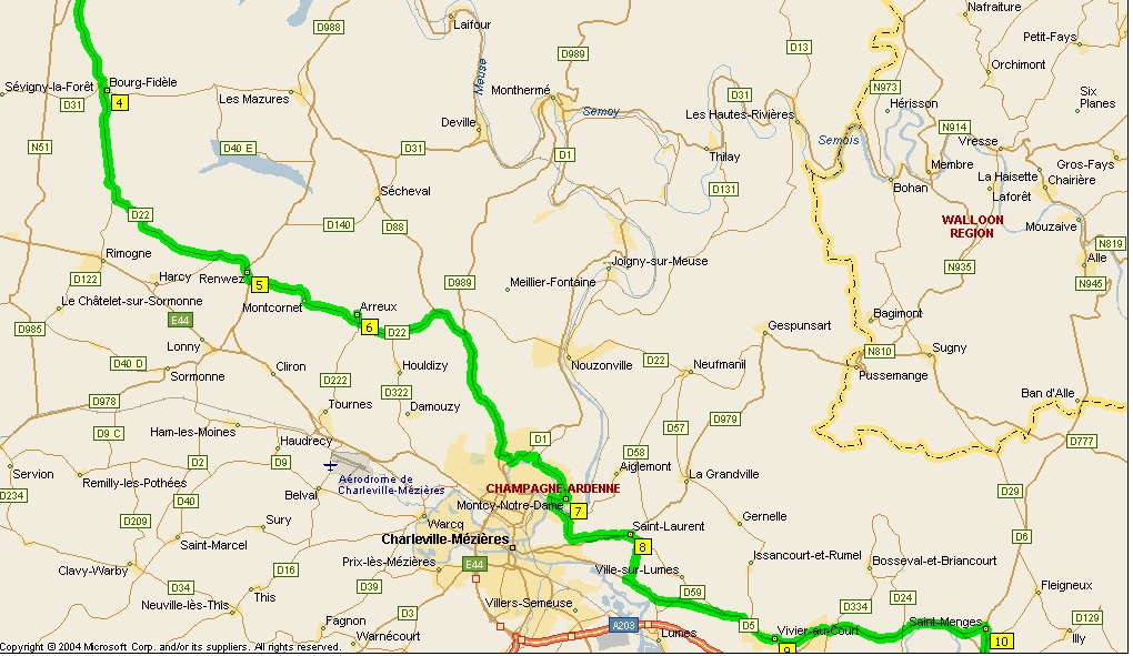
click the map
Map 3 |
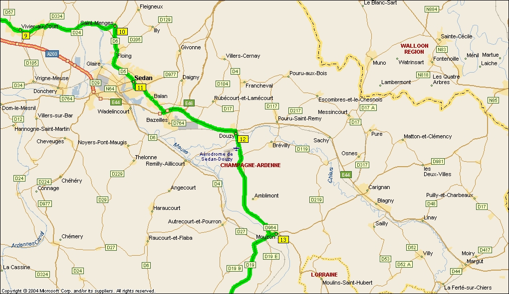
|
Camping: Sedan - Municipal la prairie Douzy - Base de Loisirs, Douzy & Camping Municipal Du Lac De Douzy Mouzon - Municipal la Tour Saint Jerome |
|
click the map
Map 4 |
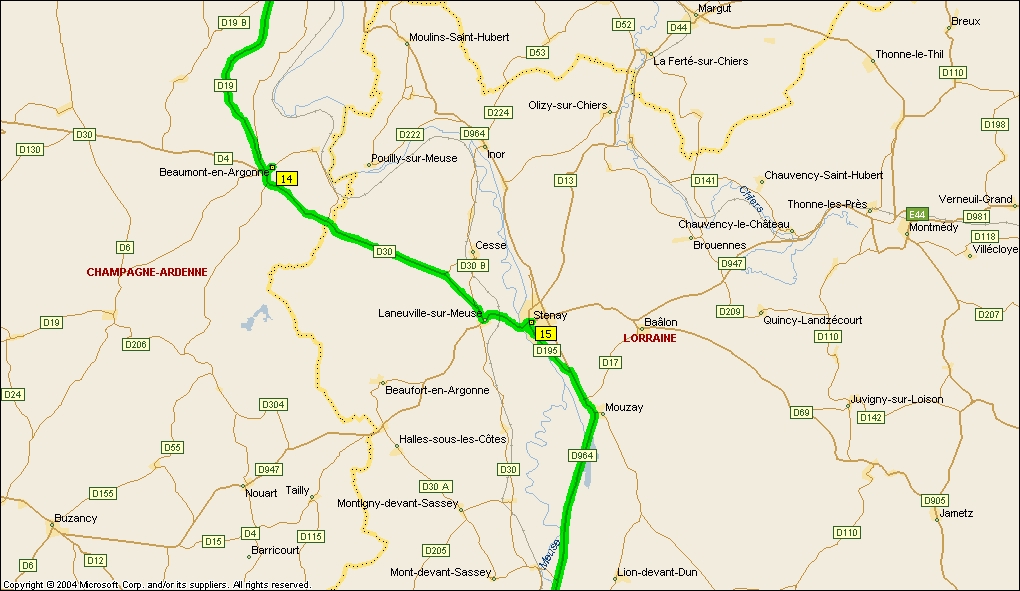
|
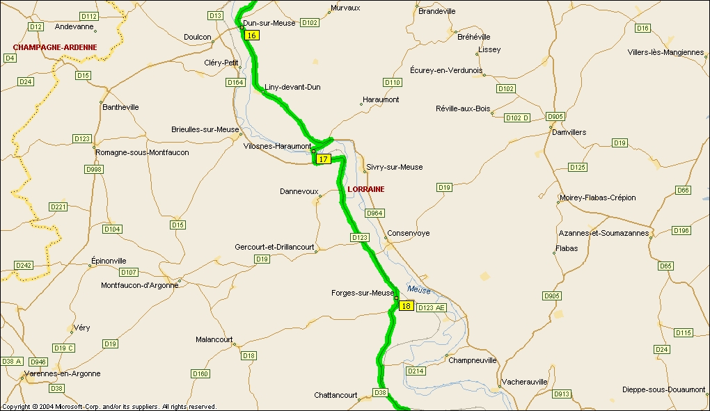
Camping: Stenay - Municipal Dun-sur-Meuse - Camping Kity Caravann-Inn, Route de Sedan |
|
click the map
Map 5 |
|
Camping: Sivry-sur-Meuse - Camping Le Brouzel, 26 r Moulin, 55110 SIVRY SUR MEUSE |
|
click the map
Map 6 |
|
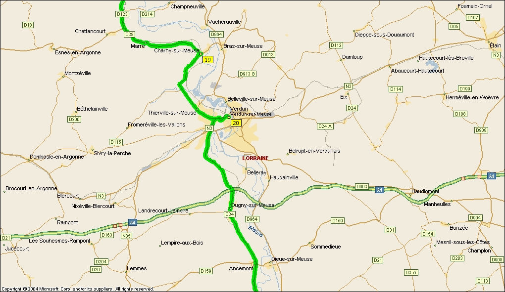
Camping: Verdun - Les Breuils, Allée des Breuils. 55100 Verdun Ancemont (Sommedieu - take D159 to left) - Camping Des Épichées, 55320 Sommedieue
In 95 we had a rest day at Verdun, we had been advised four days earlier that it would rain that day, and it did! What a downpour. We spent it sitting in the tent. |
|
click the map
Map 7 |
|
|
|
click the map
Map 8 |
|
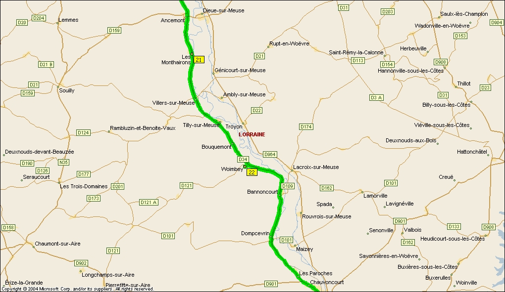
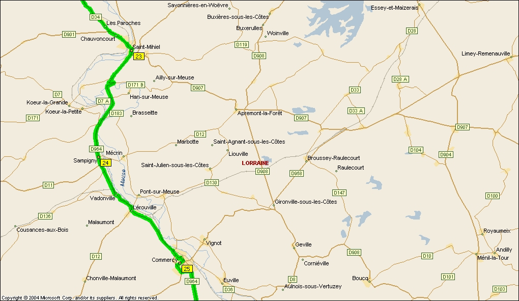
Camping: St Mihiel : Base De Plein Air, 55300 St Mihiel St Mihiel intrigued me on the way up. It is a completely Spanish town, and obviously its name is a corruption of San Miguel. Maybe I will get to explore it |
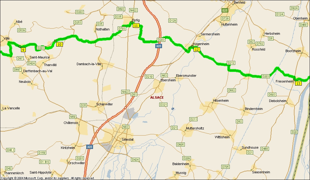
|
click the map
Map 9 |
|
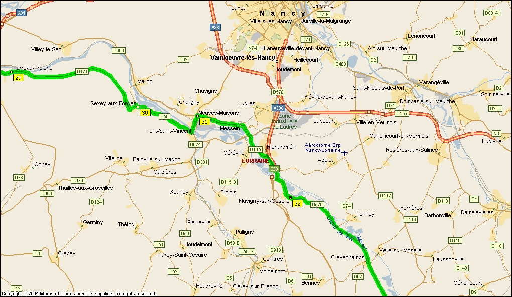
Camping: Toul (Villey-le-Sec ) 34, rue de la Gare Toul was a weird town, perfectly circular, and the streets in concentric circles, I had the feeling I was never going to get out, and I did not like the atmosphere there. There is a campsite here, but I have no intention of staying in it. |
|
click the map
Map 10 |
|
Camping: Flavigny sur moselle : Le Chaubourot, 23 rue Doyen Jacques Parisot. 54630 FLAVIGNY SUR MOSELLE The route we took was all along the Meuse and Moselle valleys, very quiet and beautiful. |
|
click the map
Map 11 |
|
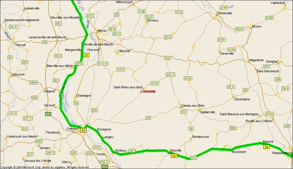
Camping: Charmes - Camping Les Îles , 20, rue de l'Écluse - 88130 CHARMES Rambervillers - Camping Municipal, 39 Rue Charles Gratia, 88700 Rambervillers Rambervillers had a very run-down air, this was the town that would not change Deutschmarks! |
|
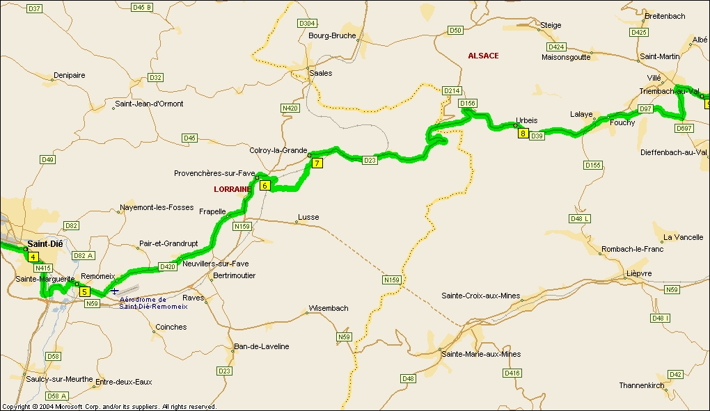
click the map
Map 12 |
|
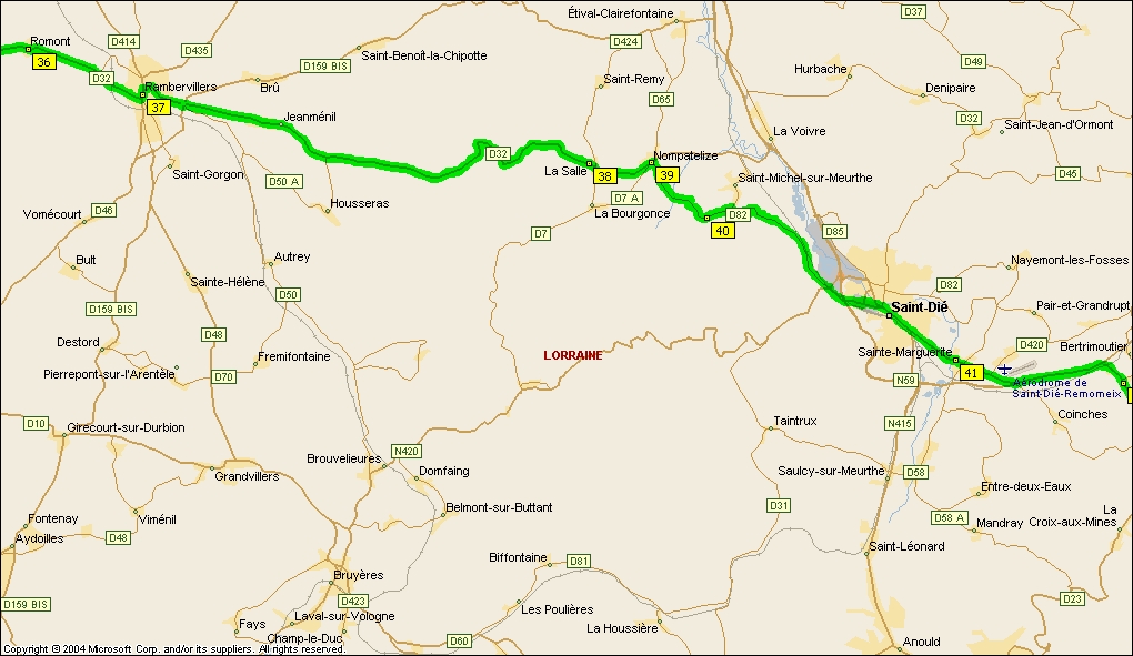
Camping: St Dié - Camping Vanne de Pierre, 5, rue du Camping - 88100 SAINT-DIÉ
It will be fun walking into the café at La Salle, where we were robbed of Wolf's money-belt and camera on our second day out, to be fair he had left it on the fountain outside the café, and the clientèle had snaffled it. We refused to leave without it, however, and in the end it was returned to us, with our passports and credit cards (but we had already cancelled the cards on discovering the theft) but minus the camera and cash. Luckily we only carried cash for the day in the money belt, so the rest of the hoard was good. St Dié was another horrible place, we could not find our way out and took a wrong road which lost us a lot of time. When the money belt was lost, Madame of the Café kept saying "You must go back to St Dié" - no fear, that was the last place we wanted to go! Actually, of course, she just wanted us off the premises so they could continue dividing the loot! |
|
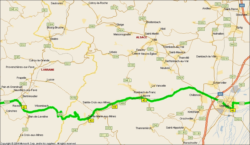
click the map
Map 13 |
|
Camping: Gemaingoutte - Camping Le Violu, 88520 GEMAINGOUTTE Sainte-Marie-aux-Mines - Camping Les Reflets du Val d'Argent, 20 route d'Untergrombach, 68160, Sainte-Marie aux Mines Lièpvre - Camping Haut-Koenigsbourg, Rue de la Vancelle - 68660 LIÈPVRE Selestat - Camping Les Cigognes, Rue de la 1ière DFL, 67600 Sélestat
Last time we stayed on the tiny campsite at Gemaingoutte, right at the foot of the Vosges, after we careered down a very bad road, full of potholes - Wolf shouting something at me over his shoulder. I could not hear him so kept trying to catch him up, at which he got more agitated. I discovered at the foot of the mountain that he had been worried the bike buggy would break loose on the bad surface, and didn't want me to have an accident running into it. However, it held good - vorsprung durch Technik! |
|
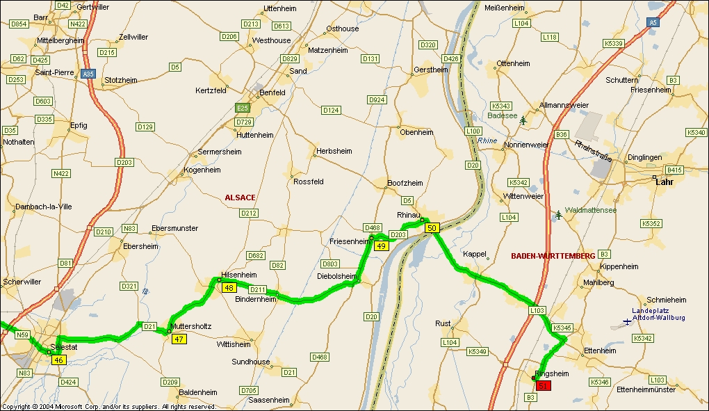
click the map
Map 14 |
|
Camping Ettenheim - Camping Park Oase, Mühlenweg 34, 77955 Ettenheim I will park up on the campsite at Ettenheim, a short distance from Ringsheim, before tackling the relatives. I can use this camp as a base for exploring the villages in the flat Rhinelands, before cycling to Offenburg and taking the Black Forest Railway to Triberg, and cycling on to Neukirch |
|
|
|
|
The whole trip |
|
|
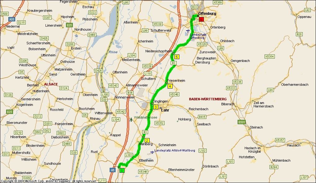
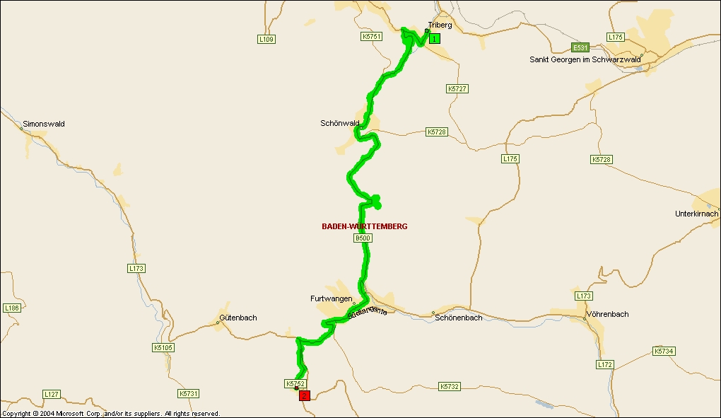
And finally . . . Ringsheim to Offenburg 20 mi
Train to Triberg, then . . . . Triberg to Neukirch 12 mi
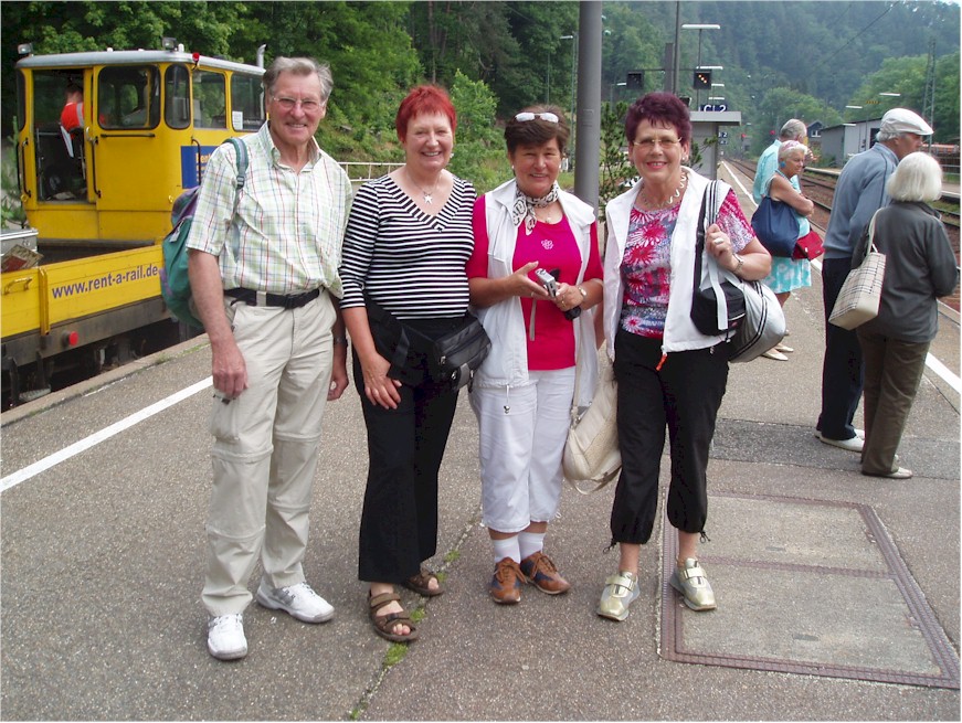
see my friends . . . . .
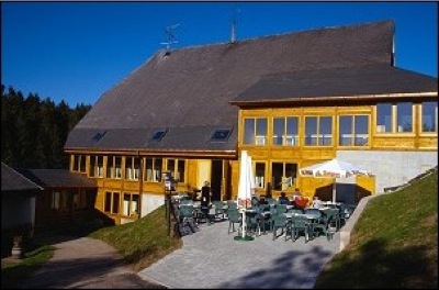
. . . . and a meal in the delightful Ochsen
|
|
Total mileage 329 and the rest!! |
|
|